But hurry: The online pre-order special ends soon!
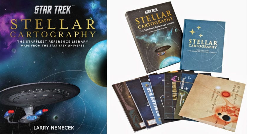
Yes, it’s an all-NEW update of the showy Star Trek: Stellar Cartography wall maps and book set — coming Oct. 9 with TEN large 2-D maps from various Trek eras and cultures and a guidebook.
The itch that first got me into Star Trek backgrounding is back again, courtesy of the good Trek-savvy folks at EpicInk and Quarto.
It’s all supposedly the Top 10 most popular “maps” as retrieved by patrons at the Federation’s Memory Alpha central library (the “real” one) in 2386— the year before the Hobus subspace shockwave “supernova” that destroyed Romulus, among other systems, the next year.
Can you see the Discovery update is this rough work draft?
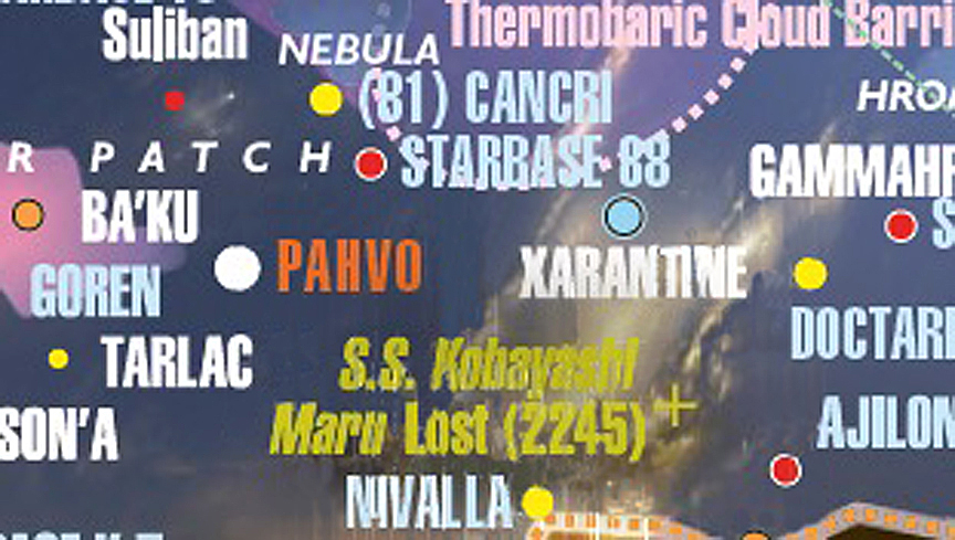
This 2018 UPDATE includes a complete add-on for every star or planet, starbase, and other stellar location mentioned through Season 1 of Discovery — with two exceptions that the writers want to do themselves (guess which!). Check out this sample (at right) of my rough mock-up from the set’s apex piece, the infamous “Map 10” — or what I call the “National Geographic mega-map” of the set)—for a clue to how we worked. The guidebook’s history text is also updated, as needed.
Plus, this update includes a good couple dozen more similar items from original 60s Trek that somehow escaped the database of the 2002 Star Trek Star Charts book this set is based on. Yes, Iotia is here now… along with the lost USS Constellation and Doomsday Machine battle …. and ALL starbases mentioned in every iteration of Trek, including TAS.
Klingon speakers will be glad to see the all-tlhIngan Hol 2266 Empire map now features accurate native verbage and iconogrpahy in both its title blocks and map IDs. That’s thanks to Klingon scholar Lievan Lietar, who translated all the Season 1 Discovery dialogue in to the Klingon language option that Netflix offered its customers as it carried the series everywhere globally outside the US and Canada.
And that clamshell box unit to hold it all is still heavy and impressive. As is a few touches of retconning and canon-smoothing that anything of this nature requires. And this time my name is even on the cover!
Of course, if you had no idea Stellar Cartography existed, or you have come to fandom in just the past 5 years — you will be as blown away by the poster maps afresh as everyone was back in 2013. Credit still goes to spacescape and graphic artists Ali Ries and Ian Fullwood. Plus, original star mapper Geof Mandell, whose “Map 10” is an homage to his groundbreaking work in the 2002 Star Charts book and his time on Voyager and Enterprise. All, of course, keyed to that basic quadrant-and-empires layout Mike Okuda developed for TNG’s “The Price” in 1989.
Again, pre-order it now! It’s 1/3 off the final list price, before it ships and appears in bookstores Oct. 9. And the earlier, the better for pre-sorders… which helps encourage future non-fiction cool ideas like this!
Just make sure you’re clicking on a box cover with the pinkish nebula in the upper-left corner. Otherwise, you might be getting instead an original 2013 set, if you overlooked the crazy collector’s prices those have been fetching online.
Trek’s factual /fictional mix of star usages is just about the first mega-passion that drew me into a heightened state of fandom — and first got me published, starting with the original pro Bantam Star Trek Maps pouched fold-out set (sentimental, but long superceded by Mike’s onscreen canon creations). All these iterations, even after the years, somehow cycle around to call be back to those first passionbs.
In hindsight, you might even say THIS has been my true star trek.